SDB Day 2019 was a big success

SDB Day 2019 was a big success

Day 1 included great talks on the rise of SDB, coastal engineering applications, and seafloor mapping projects. During Day 2, amongst many fascinating talks, the Canadian Hydrographic Service (CHS) presented a novel approach to SDB, the Great Barrier Reef habitat mapping project wowed the audience, Geoscience Australia’s intertidal model generated a lot of interest and New Zealand’s NIWA treated everyone to a presentation filled with 3D flythrough eye candy.

Presentations from the event will be soon available at the SDB Day conference web page.

Thank you to all our wonderful speakers, attendees and students as well as all the sponsors for the great support. We look forward to inviting you to SDB Day 2020.

Some of the take home messages from the conference are:

  • There is a continuously increasing uptake of calibration-independent SDB in industry and hydrographic applications.
  • The presentations showcased a range of fit-for-purpose roles for SDB, from planning and reconnaisance through to charting and change detection.
  • There is a growing requirement for bringing knowledge and quantitative methods on SDB quality assessment methods into guidelines for hydrographic offices and other users.
  • There was a considerable level of interest for the planned SDB training and certification courses to be held at EOMAP headquarters in Germany, in October 2019.

What’s behind the ground-breaking 3D habitat map of the Great Barrier Reef?

What’s behind the ground-breaking 3D habitat map of the Great Barrier Reef?

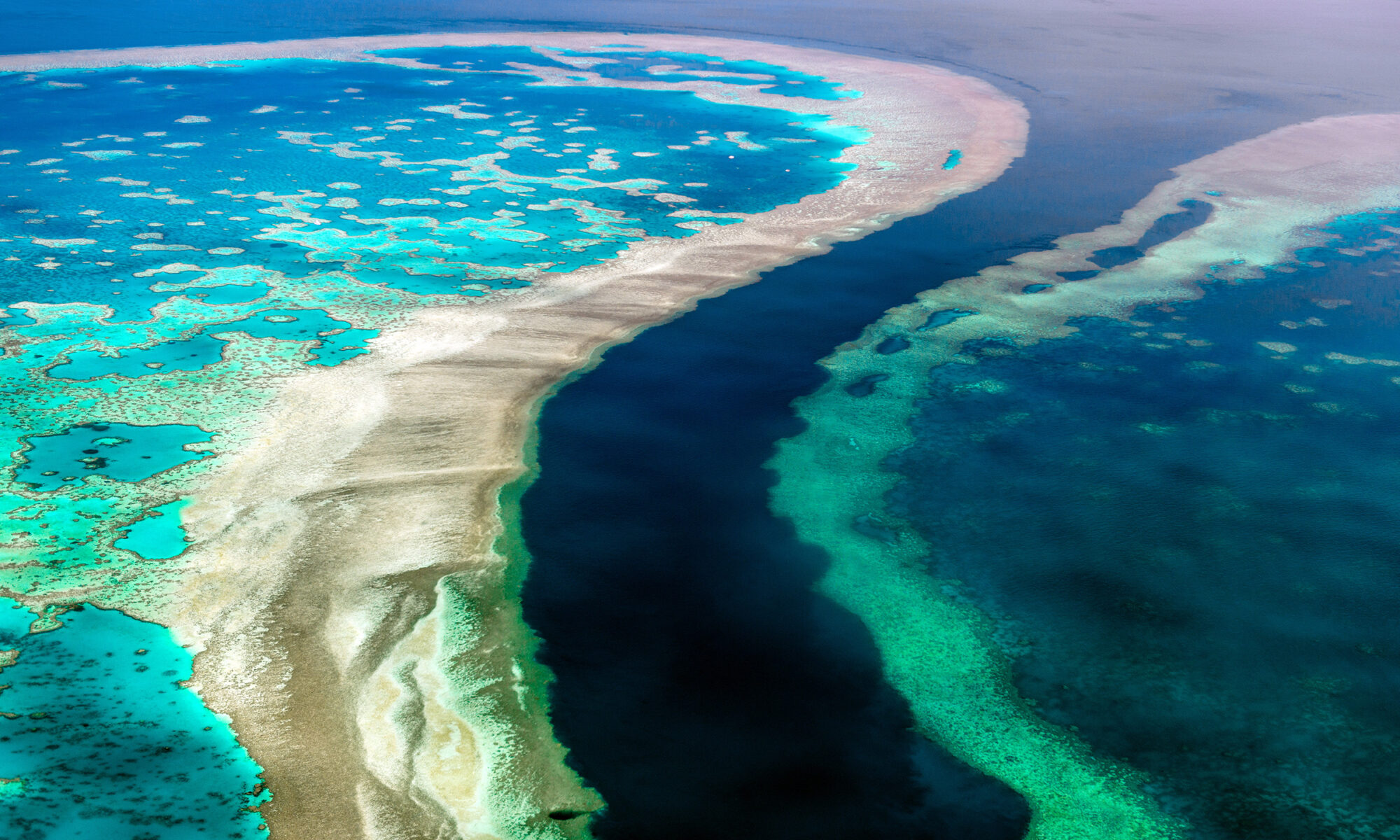
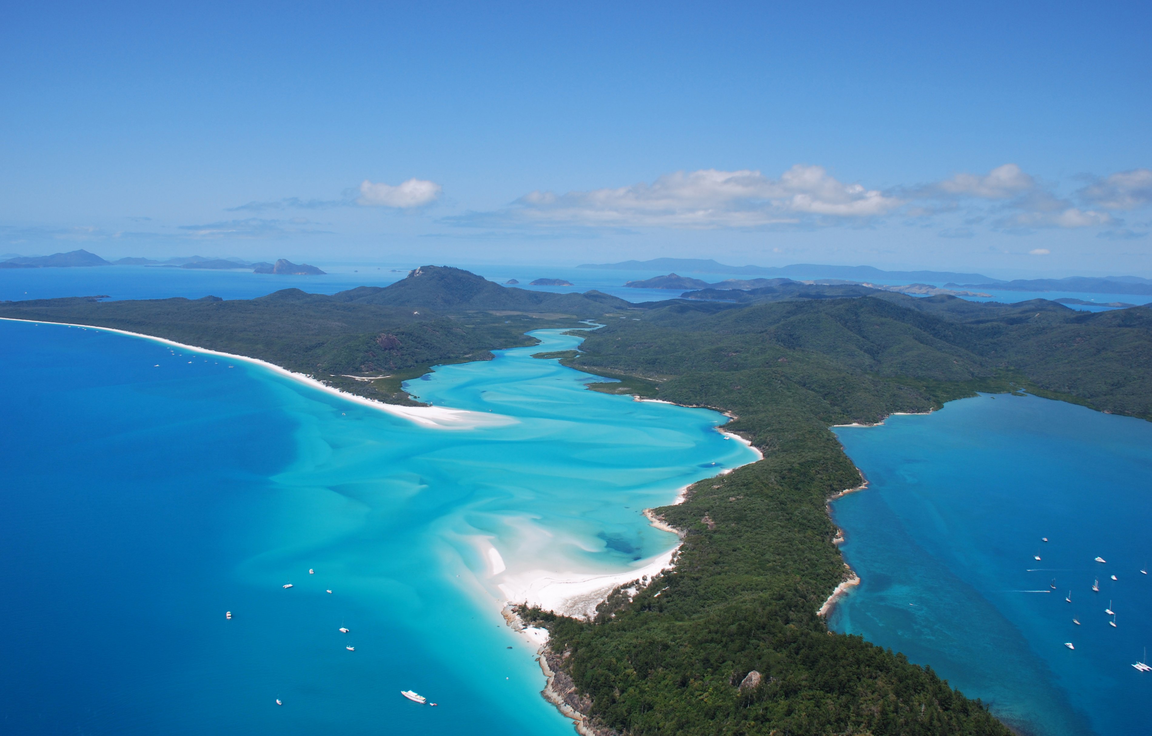
International aquatic remote sensing company EOMAP will showcase its unique contribution to the world-first 3D habitat map of the Great Barrier Reef (GBR) at the International Forum on Satellite-Derived Bathymetry, SDB Day 2019, next month in Australia.

The mapping project, ‘3D live habitats for the full extent of the Great Barrier Reef’, will provide, for the first time, maps of the predicted coral types and underwater landscape for the more than 3,000 reefs within the 350,000 km2 of the GBR.
EOMAP’s cutting edge technology provides essential data for this revolutionary project, in which the University of Queensland (UQ), Great Barrier Reef Marine Park Authority, and the Australian Institute of Marine Science are partners.

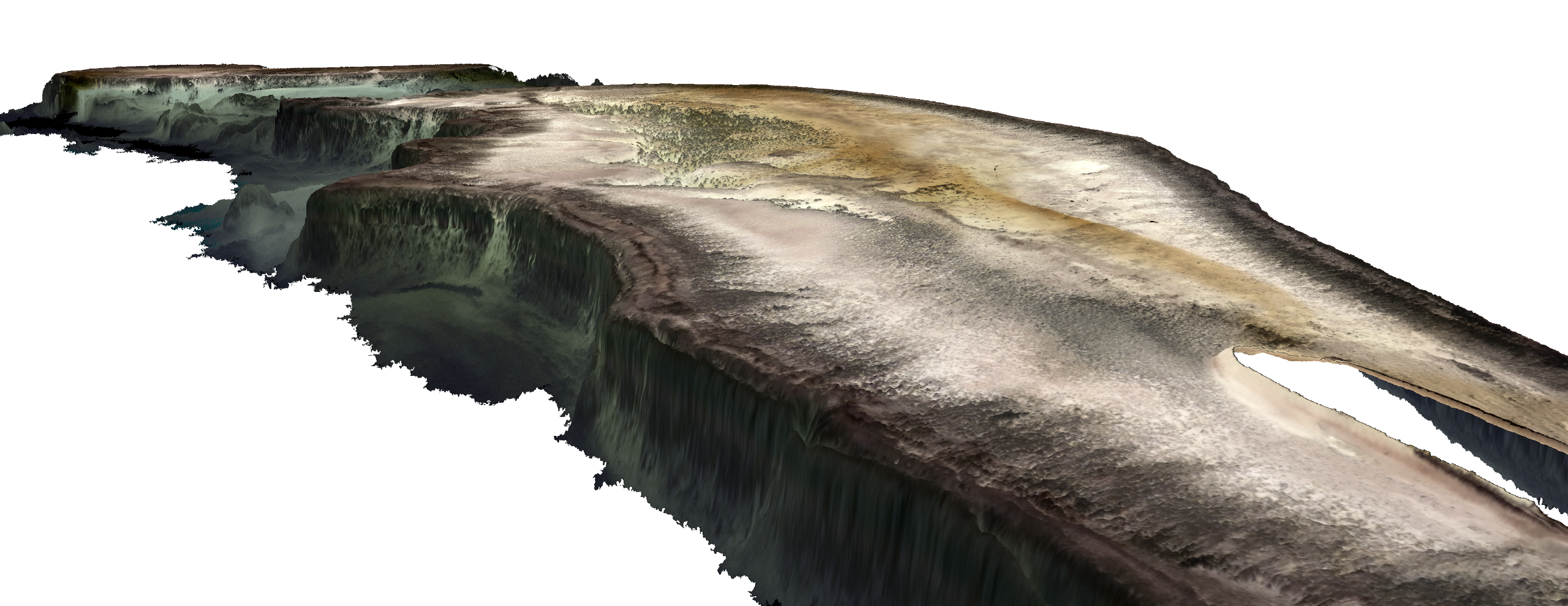
The resulting maps will be at an un-precented 10m horizontal grid resolution and reveal bathymetry (water depth), geomorphic zonations and bottom types, in addition to the predicted coral types.

“No maps exist to date that provide so much detail for every single reef,” says project leader, Dr. Chris Roelfsema from the Remote Sensing Research Centre at UQ.

He explains that a lack of detail in existing maps is an ongoing issue in environmental science. “To understand and protect an environment you need to know the highest level of detail,” he says. “It’s like managing your budget—if you don’t know exactly how much you have, then how do you know what to do?”

The ambitious scope of this undertaking was made possible by recent advances in satellite-mapping technologies, environmental modelling and image classification methods.

Using the European Space Agency Sentinel-2 platform satellite imagery, EOMAP applies its industry leading, proprietary technology to retrieve satellite-derived bathymetry (SDB) and sub-surface reflectance (SSR).

The result of the SDB mapping is a 3D elevation model of the seafloor—one of the cornerstone data layers for the entire project.

“Accurately mapping bathymetry using satellite imagery requires very sophisticated, physics-based algorithms,” explains Dr. Magnus Wettle, Managing Director of EOMAP Australia.

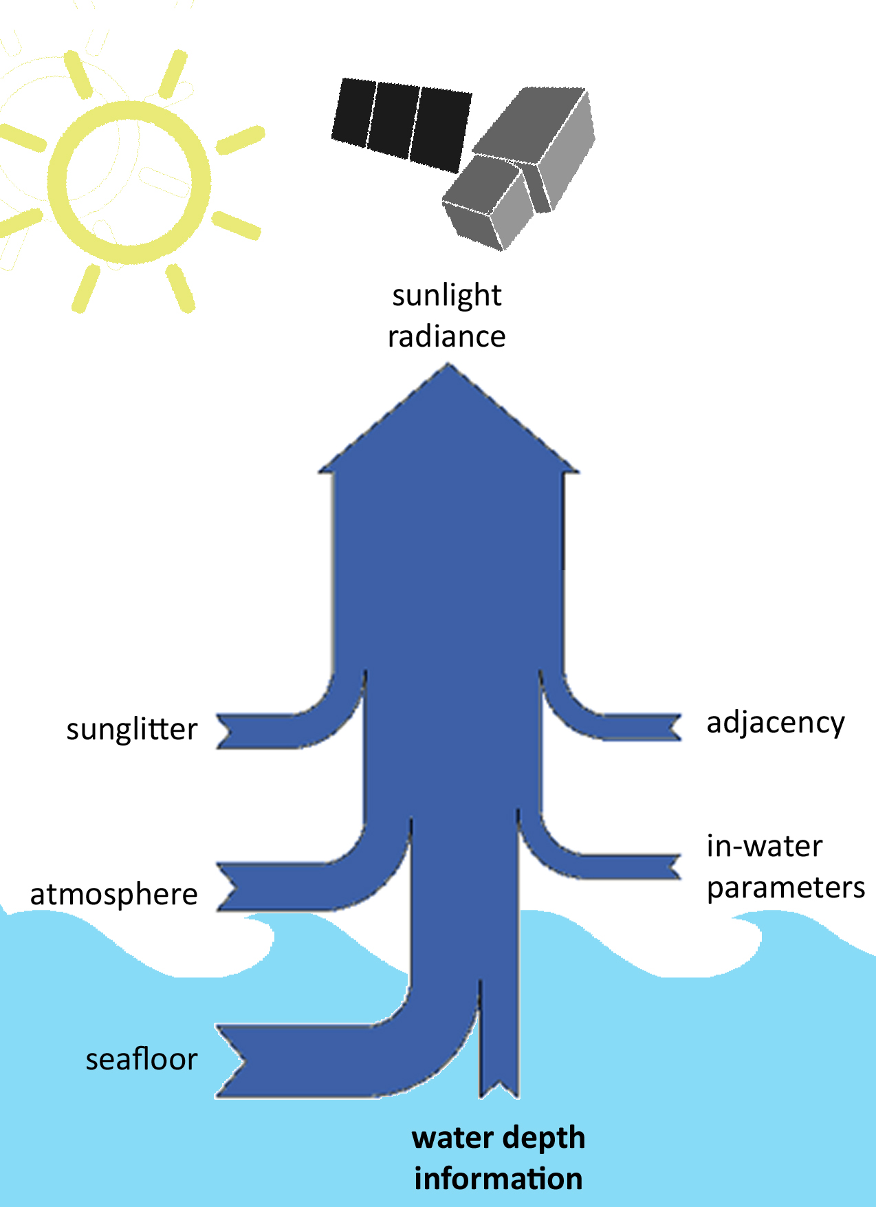
“Our algorithms are able to account for the path of sunlight as it travels down through the atmosphere, through the water column, reflects off the seafloor and back up to the earth-orbiting satellite sensor.”

Both the SDB and the SSR data are fundamental to the overall project. The SDB not only directly guides the geomorphology classification but is also used for environmental modelling input to calculate wave energy environments across the GBR. The wave energy parameter in turn informs all reef habitat classification and predicted coral types.
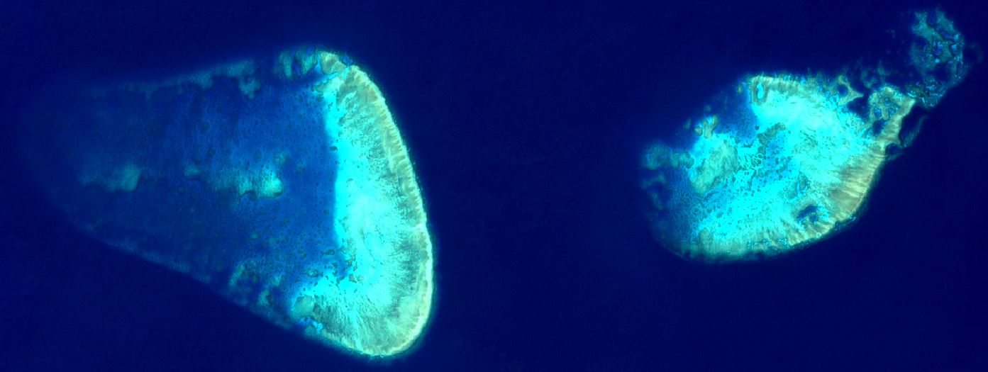
The SSR data provides marine ecologists with additional, important information, when revealing the theoretical seafloor colour for the final habitat classification. Recent advances in machine learning and semi-automated classification then enable the researchers to efficiently and accurately process and classify all the reefs of the GBR.

“The importance of the outcomes from this project cannot be overestimated,” adds Dr. Thomas Heege, CEO of EOMAP.  “As an example, to monitor coral bleaching over the entire Reef—a serious concern given recent events—you first need to know if you are looking at bleached coral habitat or at bright, reflective sediment. The 3D live habitat map gives you this baseline environmental information, correctly geo-positioned, to within 10 metres.”

“We are extremely pleased to be working alongside our project partners in helping to enable more effective monitoring and management of the global biodiversity icon that is the Great Barrier Reef,” concludes Dr. Wettle.

The latest progress on this project will be presented at SDB Day 2019, which Australia is hosting on the Sunshine Coast, 14–16 May.

Satellite-Derived Bathymetry for Coastal Monitoring Solutions

Satellite-Derived Bathymetry for Coastal Monitoring Solutions

By EOMAP

Coastal zones represent some of the most densely populated regions of the world and are under increasing pressure from man-made activities. Coastal zones are highly dynamic (Syvitski et al. 2005) and are subject to change in the short term, e.g. caused by extreme weather events, and long term, e.g. caused by erosion and currents. Offshore and coastal engineering activities can modify coastal landscapes significantly, and man-made disasters can have dramatic impacts on the coastal environment. All these changes create a high demand for spatial and environmental data to aid in coastal zone management.

A consistent spatial framework is necessary and challenging, especially because the continually shifting land–water interface poses significant logistical problems for mapping (Committee on National Needs for Coastal Mapping and Charting 2004). The extremely dynamic nature of coastal marine environments makes it especially difficult to monitor. Important issues in coastal monitoring include water characterization, observations of water-quality trends over time, identification of emerging problems, and information for pollution prevention and emergency response (Siermann et al. 2014).

Satellite-Derived Bathymetry

The greatest demand is for up-to-date shallow bathymetric data (Committee on National Needs for Coastal Mapping and Charting 2004) to provide the fundamental geospatial framework which is essential for navigation, port and offshore construction, security, coastal zone management, fisheries management, coastal restoration, and tourism.

Vessel- and aircraft-based methods for coastal monitoring surveys can be cost and time consuming, depending on the level of detail required. For these reasons, extended areas of water worldwide are not mapped in detail, or existing data may be out of date, especially in dynamic environments. The demand for bathymetric data is therefore obvious and lack of this data causes risk to navigation and concerns to the offshore industry and beyond.

SDB benefits from the S-100 standard which allows the use gridded data and other satellite derived data into hydrographic practice. However, SDB lacks on basic standard definitions on data quality, QA/QC processes, certificates, etc. – in other words: all the standards which exist for other survey methods. Defining these standards is a current and future challenge  the hydrographic community has to address. This will allow hydrographers, surveyors and bathymetric data users to gain trust in the data. Furthermore, it is of absolute necessity to allow to distinguish different SDB solutions for its use in hydrographic practice.

References:

Committee on National Needs for Coastal Mapping and Charting, Mapping Science Committee, National Research Council. 2004.
A Geospatial Framework for the Coastal Zone: National Needs for Coastal Mapping and Charting. Washington, DC: National Academies Press.
Syvitski, J., N. Harvey, E. Wolanski, W. Burnett, G. Perillo, V. Gornitz, R. Arthurton, H. Bokuniewicz, J. Campbell, L. Cooper, K. Dunton, S. Gao, P. Hesp, Y. Saito, J. Salisbury, M. Snoussi, and W. Yim. 2005. “Dynamics of the Coastal Zone.” In Coastal Fluxes in the Anthropocene, edited by C. Crossland,
H. Kremer, H. Lindeboom, C. Marshall, C. Le Tissier, and D. Martin. Berlin: Springer. doi:10.1007/3-540-27851-6_2.
Siermann, J., C. Harvey, G. Morgan, and T. Heege. 2014. “Satellite Derived Bathymetry and Digital Elevation Models (DEM).” International Petroleum Technology Conference, Kuala Lumpur, Malaysia, December 10–12. doi:10.2523/17346-MS

The International Hydrographic Organization on Hydrographic Capabilites

The International Hydrographic Organization on Hydrographic Capabilites

According to the statistics maintained by the International Hydrographic Organization, over 50 percent of the world’s coastal waters have never been surveyed. However, there are many users who require current high-quality bathymetric information for this zone, highlighting the need to fill this data gap.

The Satellite-Derived Bathymetry (SDB) technology helps to address this challenge. Initially established as a reconnaissance tool for shallo
w water bathymetry only, cutting-edge SDB techniques are increasingly used as a cost-efficient and rapid survey method for acquiring high-resolution bathymetric data down to water depths of 30 meters.

The use of this technology in applications such as safety of navigation, reconnaissance surveys, coastal zone management and
hydrodynamic modeling is increasing significantly, and there is therefore a compelling need to discuss current technological capabilities, application requirements and suitable quality standards of SDB data.

To learn more about the International Hydrographic Organization objectives, please read the interview with Dr. Mathias Jonas, Secretary General of the IHO here.


Excellent uptake of Satellite-Derived Bathymetry: First International Satellite-Derived Bathymetry Conference a resounding Success

Excellent uptake of Satellite-Derived Bathymetry: First International Satellite-Derived Bathymetry Conference a resounding Success

Munich, 13 June 2018 – With over 45 delegates from more than 15 countries around the world, the first international Satellite-Derived Bathymetry Day (SDB Day) organized by EOMAP was a great success. For the first time all relevant players came together on 6 & 7 June 2018 to anticipate what was to come for the Satellite-Derived Bathymetry (SDB) technology in the next years and revealed future opportunities for providers and users.

EOMAP CEO, Dr. Thomas Heege, commented: “The support for the SDB Day was fantastic. All relevant institutions – hydrographic offices, marine industry, service providers and research institutes – picked up on the themes of capabilities, data integration, requirements and quality standards. Joint considerations are really coming to the force, which is great to see.”

Presentations at the SDB Day 2018 reflected a great optimism for the SDB technology. Dr. Mathias Jonas, Secretary General of the International Hydrographic Organization (IHO) stated: “Satellite-Derived Bathymetry has arrived into practice and it has matured as a regular means for shallow water surveys. The SDB Day was an excellent platform for providers and users. For the global standardization of hydrography, we have understood that we need to adopt this new technology in the IHO framework and see how to associate it to our technical standardization and how to anchor it with our education and training programs.”

Dr. Magnus Wettle, Managing Director at EOMAP Australia, said the involvement of speakers underlined the growing importance of the SDB technology for shallow water surveys. “We are happy that the conference came up with such an impressive uptake on SDB, and with the support of providers and users we can all play an active part in this ongoing initiative.”

As a result and initiated by the participants, first steps were taken to form a Satellite-Derived Bathymetry Working Group.

“SDB is recognized as part of an integrated approach for nearshore mapping alongside with traditional survey methods”, said Dr. Marco Filippone, Chief Hydrographer at Fugro. He concluded: “We can use SDB to augment existing technology as a benchmark for high definition data sets and with this new technique develop together enabling technology, processing workflows and machine learning – and we can really speed up the process providing the final users with a product that can be used for their needs.”

The next SDB Day will be announced shortly.

Initially established as a reconnaissance tool for shallow water bathymetry only, cutting-edge SDB techniques are increasingly used as a cost-efficient and rapid survey method for acquiring high-resolution bathymetric data down to water depths of 30 meters.

More information about the conference is available at www.sdbday.org.

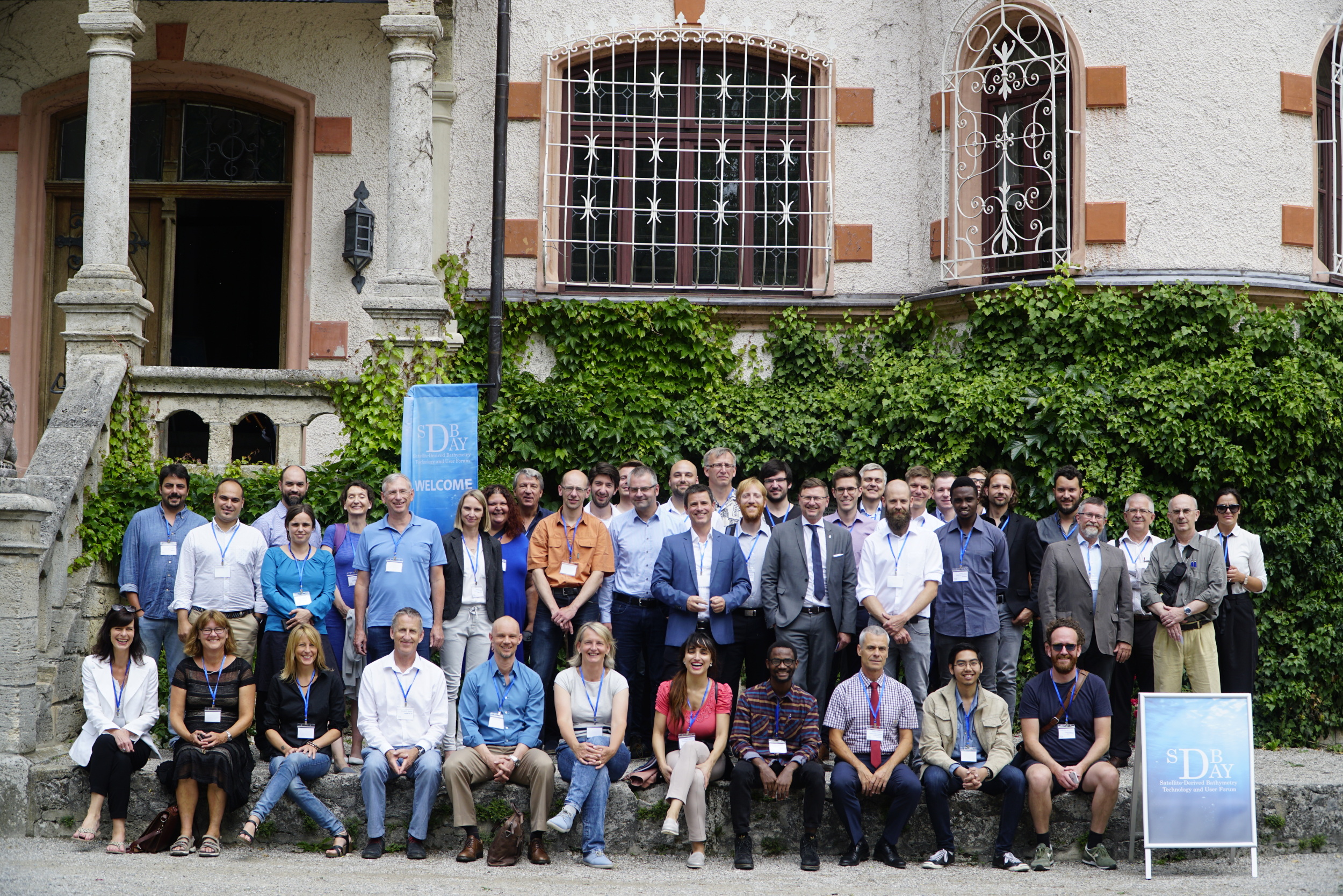
Participants of the first international Satellite-Derived Bathymetry Technology and User Forum, SDB Day 2018, 6 & 7 June 2018, Germany
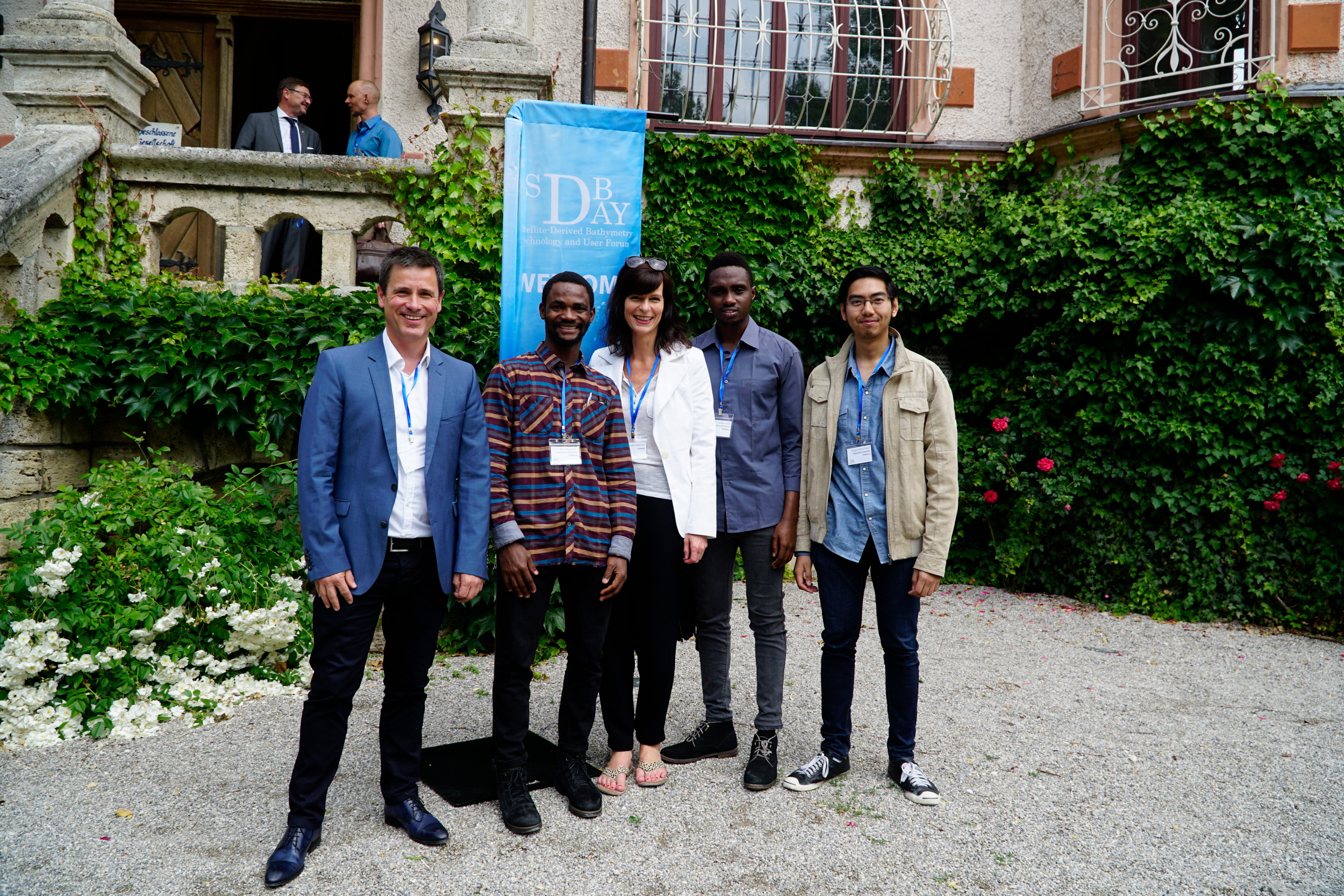
Hydrography Master Students from the HafenCity Universität Hamburg (HCU) at the SDB Day 2018, Germany

Effective Surveying Tool for Shallow-water Zones: Satellite-Derived Bathymetry

Effective Surveying Tool for Shallow-water Zones: Satellite-Derived Bathymetry

By Dr. Thomas Heege, Dr. Knut Hartmann, Dr. Magnus Wettle

January 5, 2017

A recent article provides an overview of satellite-derived bathymetry methods and how data can be integrated into survey campaigns, and showcases three use cases. Bathymetric data in shallow-water zones is of increasing importance to support various applications such as safety of navigation, reconnaissance surveys, coastal zone management or hydrodynamic modelling. A gap was identified between data demand, costs and the ability to map with ship and airborne sensors. This has led to the rise of a new tool to map shallow-water bathymetry using multispectral satellite image data, widely known as satellite-derived bathymetry (SDB).

Strictly speaking, the methods to derive information on seafloor topography using reflected sunlight date back to the 1970s but it has required iterative improvements of algorithms, computational power, satellite sensors and processing workflows to provide the current state of the art tool. Today, a range of different methods exist under the umbrella of the SDB term. However, as with traditional survey methods, it is imperative to understand the advantages, disadvantages and overall feasibility in order to evaluate the suitability and fit-for-purpose of a given SDB application.

Bathymetric Data Production using Optical Satellite Imagery

Historically, empirical methods were used, which require known depth information over the study area. By comparing these known depths with the satellite signal, a statistical relationship can be derived that adequately describes depth as a function of the signal. Aside from requiring known depth data, these methods will only work for a given satellite image. A subsequent satellite scene, even of the same location, may contain different atmospheric and in-water parameters, and thus the statistical relationship needs to be re-calculated.

To learn more, please read on EOMAP on Satellite Derived Bathymetry.