
What’s behind the ground-breaking 3D habitat map of the Great Barrier Reef?
International aquatic remote sensing company EOMAP will showcase its unique contribution to the world-first 3D habitat map of the Great Barrier Reef (GBR) at the International Forum on Satellite-Derived Bathymetry, SDB Day 2019, next month in Australia.
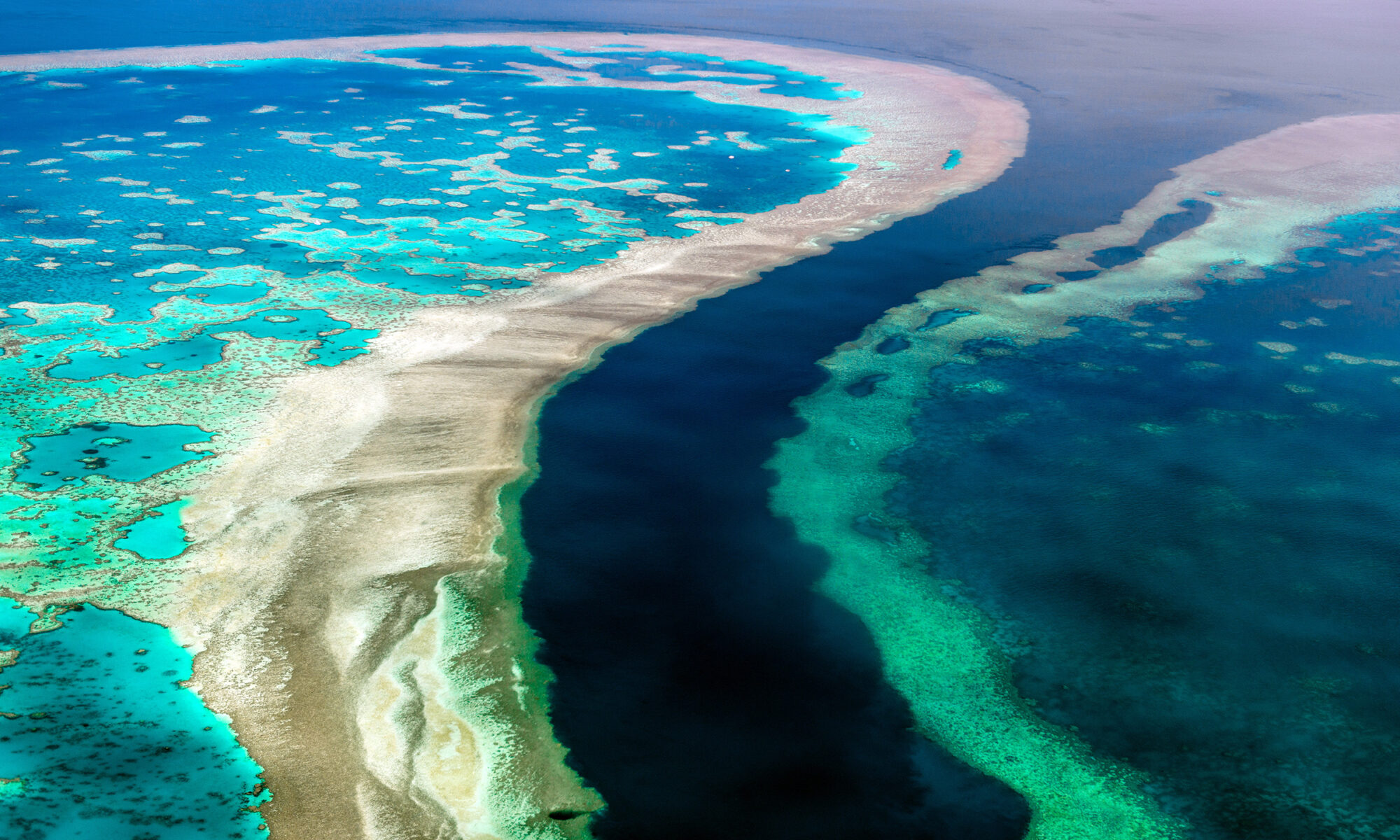
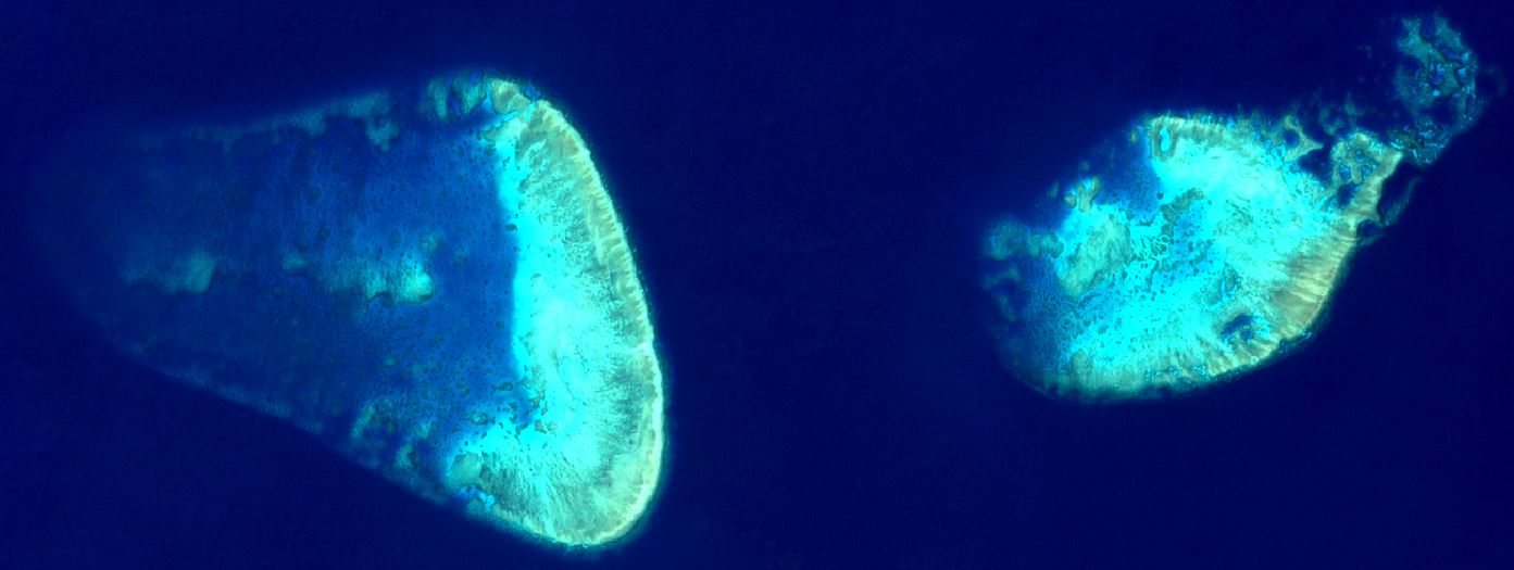
The mapping project, ‘3D live habitats for the full extent of the Great Barrier Reef’, will provide, for the first time, maps of the predicted coral types and underwater landscape for the more than 3,000 reefs within the 350,000 km2 of the GBR.
EOMAP’s cutting edge technology provides essential data for this revolutionary project, in which the University of Queensland (UQ), Great Barrier Reef Marine Park Authority, and the Australian Institute of Marine Science are partners.
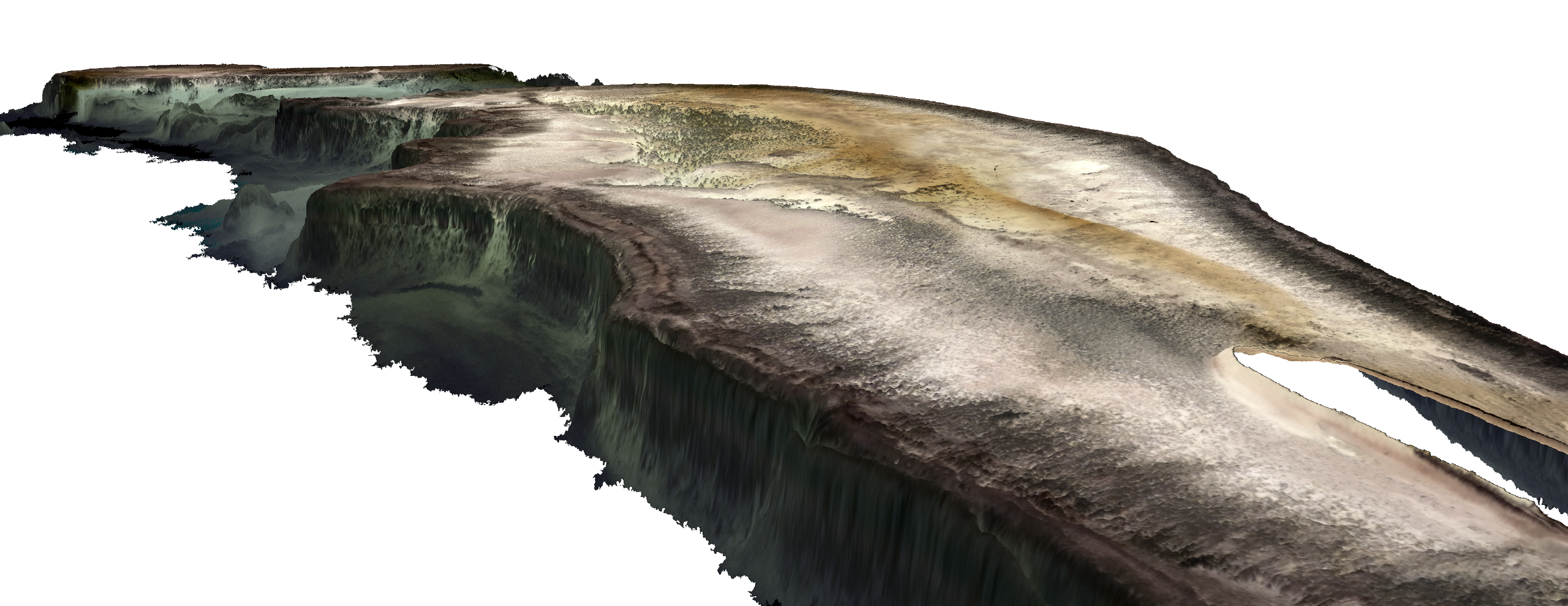
The resulting maps will be at an un-precented 10m horizontal grid resolution and reveal bathymetry (water depth), geomorphic zonations and bottom types, in addition to the predicted coral types.
“No maps exist to date that provide so much detail for every single reef,” says project leader, Dr. Chris Roelfsema from the Remote Sensing Research Centre at UQ.
He explains that a lack of detail in existing maps is an ongoing issue in environmental science. “To understand and protect an environment you need to know the highest level of detail,” he says. “It’s like managing your budget—if you don’t know exactly how much you have, then how do you know what to do?”
The ambitious scope of this undertaking was made possible by recent advances in satellite-mapping technologies, environmental modelling and image classification methods.
Using the European Space Agency Sentinel-2 platform satellite imagery, EOMAP applies its industry leading, proprietary technology to retrieve satellite-derived bathymetry (SDB) and sub-surface reflectance (SSR).
The result of the SDB mapping is a 3D elevation model of the seafloor—one of the cornerstone data layers for the entire project.
“Accurately mapping bathymetry using satellite imagery requires very sophisticated, physics-based algorithms,” explains Dr. Magnus Wettle, Managing Director of EOMAP Australia.
“Our algorithms are able to account for the path of sunlight as it travels down through the atmosphere, through the water column, reflects off the seafloor and back up to the earth-orbiting satellite sensor.”
Both the SDB and the SSR data are fundamental to the overall project. The SDB not only directly guides the geomorphology classification but is also used for environmental modelling input to calculate wave energy environments across the GBR. The wave energy parameter in turn informs all reef habitat classification and predicted coral types.
The SSR data provides marine ecologists with additional, important information, when revealing the theoretical seafloor colour for the final habitat classification. Recent advances in machine learning and semi-automated classification then enable the researchers to efficiently and accurately process and classify all the reefs of the GBR.
“The importance of the outcomes from this project cannot be overestimated,” adds Dr. Thomas Heege, CEO of EOMAP. “As an example, to monitor coral bleaching over the entire Reef—a serious concern given recent events—you first need to know if you are looking at bleached coral habitat or at bright, reflective sediment. The 3D live habitat map gives you this baseline environmental information, correctly geo-positioned, to within 10 metres.”
“We are extremely pleased to be working alongside our project partners in helping to enable more effective monitoring and management of the global biodiversity icon that is the Great Barrier Reef,” concludes Dr. Wettle.
The latest progress on this project will be presented at SDB Day 2019, which Australia is hosting on the Sunshine Coast, 14–16 May.